Delhi Metro Embraces Indigenous Mappls AI for Real-Time Smart Commutes
Redefining urban travel: Mappls and DMRC partner for AI-powered, real-time metro navigation and integrated mobility solutions.
October 31, 2025
In a significant move poised to reshape the daily commute for millions, the Delhi Metro Rail Corporation (DMRC) has entered into a Memorandum of Understanding (MoU) with the indigenous digital mapping firm Mappls MapmyIndia. This strategic partnership will see the comprehensive integration of Delhi Metro's data into the Mappls mobile application, aiming to provide a seamless, real-time, and technologically advanced travel experience for commuters across the National Capital Region (NCR). The collaboration represents a major step forward in creating a more connected and intelligent public transport ecosystem, leveraging homegrown technology to solve complex urban mobility challenges. For the more than 35 million users of the Mappls app, this integration promises a transformative shift in how they plan and undertake their journeys on one of the world's largest metro networks.
The primary objective of this collaboration is to eliminate friction in journey planning and enhance commuter convenience through a suite of integrated features.[1] By embedding DMRC's official Application Programming Interface (API) into its platform, Mappls will offer users a one-stop solution for all metro-related information.[2][3] Commuters will be able to access detailed information including the locations of nearby metro stations, optimal routes, fare calculations, train frequencies, and estimated travel times directly within the app.[4][5] The system will also provide crucial details on interchange stations and line changes, simplifying navigation through Delhi's extensive multi-line network.[2] DMRC Managing Director, Dr. Vikas Kumar, emphasized that the initiative is aligned with the corporation's commitment to leveraging innovation and technology for passenger benefit, stating that the collaboration will enable commuters to "plan better, navigate easily, and save time."[2] This partnership moves beyond static information, aiming to provide real-time updates that are critical for daily commuters, making travel across the NCR smarter and more seamless.[2]
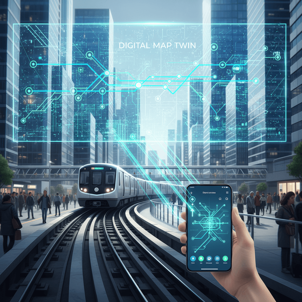
At the heart of this integration is a sophisticated application of geospatial and artificial intelligence technologies designed to create a more dynamic and responsive navigation tool. Mappls plans to incorporate the DMRC data into a multi-modal transport feature, allowing users to plan their trips from the first to the last mile, combining metro travel with other modes like feeder buses.[2] A key technological component is the development of a "Digital Map Twin of the Real World," a concept MapmyIndia has been pioneering.[6] This involves creating a detailed, 3D, and 360-degree virtual replica of the physical world, which in this context will include the entire Delhi Metro network.[7][6] This digital twin is not just a static map but is continuously updated with real-time data, allowing for advanced simulation and analysis.[7][6] Mappls' AI-driven engine utilizes this data to power features like live traffic intelligence, which helps in providing more accurate estimated times of arrival by factoring in real-world conditions.[5][8] Furthermore, the app includes unique, India-centric safety alerts for hazards like potholes and speed breakers, and advanced visualization tools like 3D junction views to help navigate complex flyovers and interchanges, features that are now extended to the metro journey experience.[9] The integration will also connect with Mappls' Traffic and Public Engagement Platform, empowering users to report civic issues like congestion or waterlogging, with the data being shared with relevant authorities for faster resolution.[5]
This MoU carries immense strategic significance for Mappls MapmyIndia, solidifying its position as a formidable domestic competitor to global mapping giants like Google Maps and a key partner in India's push for technological self-reliance, or 'Aatmanirbhar Bharat'.[2] This collaboration follows closely on the heels of a similar agreement with Indian Railways, indicating a clear strategy of embedding its technology within the nation's critical public infrastructure.[5] While DMRC has previously partnered with Google Maps, as far back as 2010 and again in 2017, to provide route and fare information, the Mappls integration appears to be more comprehensive, leveraging a deeper, API-level connection and a wider array of dynamic, AI-powered features.[1][4][10] Rakesh Verma, Co-Founder and Chairman of MapmyIndia, highlighted the "Swadeshi" aspect of the partnership, reinforcing the company's commitment to developing world-class indigenous technology.[2] By securing these high-profile government collaborations, MapmyIndia not only expands its massive user base but also demonstrates the capability of its hyperlocal, India-focused mapping solutions, which often provide more detailed and accurate data in local contexts than their international counterparts.[9]
The DMRC-Mappls agreement is emblematic of a broader, transformative trend in India's urban mobility landscape, where the focus is shifting towards integrated, data-driven transportation networks. As Indian cities grapple with congestion and an expanding population, the need for a unified and efficient public transit system has become paramount.[11] The concept of Mobility-as-a-Service (MaaS), which seamlessly integrates various forms of transport services into a single digital platform, is gaining traction.[11] Such public-private partnerships are crucial for realizing this vision, as they combine the extensive infrastructure of public bodies like DMRC with the technological agility and innovation of private tech firms like MapmyIndia.[11] The promotion of open data networks, where transport authorities share real-time information, is a key enabler of this revolution, allowing developers to build sophisticated applications that enhance commuter convenience and operational efficiency.[12] This move towards integrated systems promises not only to make daily travel more predictable and less stressful but also to encourage a greater shift from private vehicles to public transport, contributing to more sustainable and accessible urban environments for the future.[13]
In conclusion, the collaboration between DMRC and Mappls MapmyIndia is more than a simple data-sharing agreement; it is a landmark initiative that signals the future of urban commuting in India. By placing powerful, real-time information and advanced planning tools into the hands of millions of commuters, the partnership is set to deliver a smarter, safer, and more seamless travel experience across the Delhi NCR. For MapmyIndia, it marks another significant milestone in its journey to become the nation's preeminent digital mapping platform, championing the cause of indigenous technology in a competitive global market. Ultimately, this synergy between a vital public service and a leading technology firm serves as a powerful model for the future development of smart cities, where data-driven collaboration is the key to building a more connected, efficient, and user-centric public transportation ecosystem for a rapidly urbanizing India.