ideaForge Unveils Q6V2 GEO: Maps Anything, Anywhere in Extreme Environments
Unveiling the Q6V2 GEO: A resilient, high-precision drone engineered to map anything, anywhere for critical industry insights.
August 20, 2025
In a significant advancement for the geospatial intelligence sector, drone technology leader ideaForge has officially launched its latest Unmanned Aerial Vehicle (UAV), the Q6V2 GEO.[1][2] Unveiled at the company's inaugural customer event, PRAGYA 2025, this new platform is engineered to "map anything, anywhere," promising robust performance across all terrains and in the most extreme environmental conditions.[1][3] The survey-grade UAV is distinguished by its considerable flight endurance, advanced sensor integration, and modular versatility, positioning it as a pivotal tool for a wide array of industries including urban planning, mining, agriculture, and disaster management.[4][5] With the ability to carry LiDAR payloads for over 50 minutes and weighing under 7 kilograms, the Q6V2 GEO represents a critical step forward in accessible, high-precision aerial mapping and data collection.[1][2]
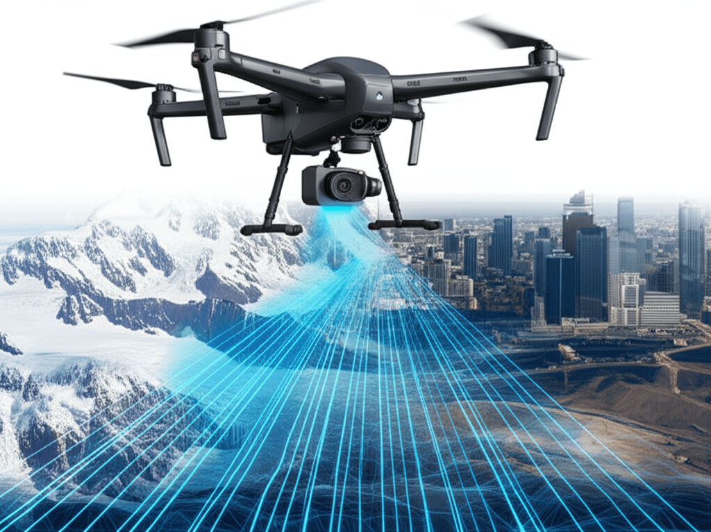
The core of the Q6V2 GEO's innovation lies in its exceptional endurance and all-terrain capabilities, designed to operate where conventional mapping technologies falter.[6][3] It has been purpose-built to function in diverse and challenging environments, from the high altitudes of Himalayan glaciers to the complexity of dense urban landscapes and the vastness of industrial corridors.[1][5] The drone's operational temperature range is notably wide, capable of flying in conditions from -30°C to +50°C, ensuring mission readiness in extreme heat and cold.[6][7] This resilience is complemented by a flight time exceeding 50 minutes while carrying a LiDAR payload, a key metric for maximizing data capture over large areas in a single mission.[1][2] The UAV's design, which maintains a take-off weight of under 7 kilograms, enhances its portability and allows for rapid field deployment, a crucial factor for time-sensitive applications like disaster response and compliance reporting.[3][5]
At the heart of the Q6V2 GEO's functionality is its capacity for survey-grade accuracy and its versatile, modular payload system. Precision is achieved through a combination of an advanced on-board Inertial Measurement Unit (IMU), Post-Processing Kinematic (PPK) enabled geotagging, and seamless integration with Continuously Operating Reference Stations (CORS).[1][3] This technical suite ensures the high level of accuracy required for demanding projects in sectors like infrastructure auditing and mining volume calculation.[4][5] What truly sets the platform apart is its ability to adapt to numerous missions through five modular and third-party payload options.[1][4] This flexibility allows operators to seamlessly switch between different sensors, including high-resolution photogrammetry with the newly launched 61 MP AI-enabled SHODHAM M61 payload, LiDAR for creating detailed 3D models, oblique imaging, hyperspectral sensing for environmental analysis, and thermal detection for inspections and surveillance.[4][3]
The launch of the Q6V2 GEO, paired with ideaForge's new geospatial technology stack and secure Flyght Cloud platform, is poised to create significant impact across numerous industries by transforming raw aerial data into actionable intelligence.[1][3] For urban planning, the drone can build detailed 3D city models and assist in infrastructure audits.[4][8] In the mining sector, it offers a solution for calculating stockpile volumes and automating compliance reports.[4][5] Utility companies can leverage the Q6V2 GEO for tower inspections and assessing vegetation encroachment risks.[4][8] Furthermore, its capabilities extend to environmental management, aiding forestry and water resource managers with biomass analysis and habitat monitoring.[4] In agriculture, it can empower farmers with tools for the early detection of crop stress.[4] The drone has already been deployed in critical projects, including mapping Himalayan glaciers for avalanche prevention and large-scale urban mapping in Varanasi for municipal governance, demonstrating its real-world utility.[1][3]
In conclusion, the introduction of the ideaForge Q6V2 GEO marks a substantial milestone in the evolution of geospatial intelligence. By combining extended flight time, extreme environment resilience, and a highly versatile payload system, the platform addresses a critical need for efficient and accurate mapping in previously inaccessible or cost-prohibitive scenarios.[1][6][3] This single, adaptable system empowers government agencies, researchers, and a multitude of industries to capture and analyze critical data with unprecedented ease and precision.[1][9] As sectors increasingly rely on data-driven insights to navigate complex challenges, the Q6V2 GEO stands out as a powerful enabler, bridging the gap between complex aerial data acquisition and intelligent, decision-ready information that can shape the future of infrastructure, environmental stewardship, and public safety.[4][3]